


אנה ברוק מרצה וראש המעבדה לספקטרוסקופיה וחישה מרחוק בחוג לגיאוגרפיה ולימודי סביבה, אוניברסיטת חיפה. תחומי מחקר הם: פיתוח אמצעים וגישות לניתוח מרחבי-זמן כולל נתוני תלת-ממד להערכת השפעותיו אסונות טבע ומזג אוויר קיצוני, חקר שיטות ואלגוריתמים לניתוח אותות ותמונה לניהול לפני ואחרי האסון, מיזוג בין הנתונים הספקטרליים לנתונים מרחביים-עיתיים ההופך את תוצרי המחקר רלוונטיים וחדשניים ליישומים סביבתיים.
אתר אישי
https://sites.hevra.haifa.ac.il/abrook/
http://carmel-ltd.haifa.ac.il/index.php/explore-tech-inn/huresearchers/138-anna-brook
מחקר נוכחי
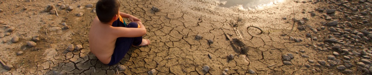
Hyperspectral Analysis of Post-fire Burned Top-Soil as a Tool for Comprehensive Evaluation of Ash Distribution in space and in time
Binational Science Foundation USA-ISRAEL
תקציר רלוונטי
REMOTE SENSING TECHNIQUES TO ASSESS POST-FIRE EFFECTS AT THE HILLSLOPE AND SUB-BASIN SCALES VIA MULTI-SCALE MODEL
- A. Brook1, M. Polinova1, D. Kopel1, D. Malkinson2, L. Wittenberg2, D. Roberts3, and N. Shtober-Zisu41Spectroscopy & Remote Sensing Laboratory, Center for Spatial Analysis Research (UHCSISR), Department of Geography and Environmental Studies, University of Haifa, Mount Carmel, 3498838, Israel
2Geomorphology Laboratory, Department of Geography and Environmental Studies, University of Haifa, Israel
3Geography Department, University of California Santa Barbara, Santa Barbara, CA, USA
4Department of Israel Studies, University of Haifa, Israel
Keywords: Multiscale model, log-Gaussian Cox processes, hillslope micro-topography, post-fire environmentAbstract.Post-fire environmental footprint is expected at varying scales in space and in time and demands development of multi-scale monitoring approaches. In this paper, a spatially and temporally explicit multi-scale model that reveals the physical and morphological indicators affecting hillslope susceptibility at varying scales, is explained and demonstrated. The qualitative and quantitative suitability classification procedures are adapted to translate the large-scale space-borne data supplied by satellite systems (Landsat OLS8 and Sentinel 2 and 3) to local scale produced by a regional airborne survey performed by unmanned aerial vehicle (UAV). At the smallest spatial and temporal resolution, a daily airborne imagery collection by UAV is linked to micro-topography model, using statistical and mathematical approaches.
https://www.int-arch-photogramm-remote-sens-spatial-inf-sci.net/XLII-1-W1/135/2017/