![]()
![]()
![]()


Michal Ben Gal
חוקרים: ערן פייטלסון, מיה נגב, אהוד סגל, ערן רזין ויונת ריין-ספיר (אונ' עברית)
מטרת המחקר
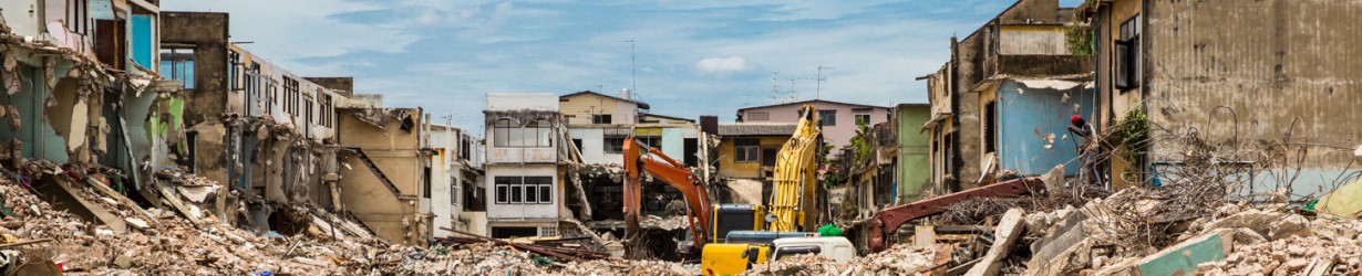
רעידת אדמה חזקה בישראל היא בלתי נמנעת וללא היערכות מתאימה היא צפויה לגרום לפגיעה נרחבת בנפש, בגוף, ברכוש ובתפקוד הכלכלי-חברתי המשקי לאורך תקופה ממושכת. חיזוק מבנים בסיכון גבוה הוא האמצעי האפקטיבי ביותר לצמצום הנזק בנפש וברכוש ולהבטחת התפקוד המשקי אחרי הרעידה.
היערכות מיטבית בתחום זה חייבת לכלול ניהול סיכונים מושכל, הממוקד במבנים המצויים בסיכון גבוה במיוחד. מחקרים מצביעים על כ-70,000 יחידות דיור שאינן עומדות בתקן הבנייה לרעידות אדמה במבנים בגובה שלוש קומות למעלה, הממוקמים באזורים בסיכון סיסמי גבוה; מתוכם כ-40,000 יחידות דיור הן בסיכון גבוה במיוחד.
חיזוק מבני מגורים בבעלות פרטית אינו מצוי באחריותו של גוף ממשלתי כלשהו. לממשלת ישראל חסרה כעת מדיניות כוללנית שתפחית את סיכוני רעידות האדמה בצורה מושכלת, למרות שחיזוק סיסמי של מבני מגורים הוא כשל שוק מובהק המחייב התערבות ממשלתית. תמ"א 38 אינה מהווה תחליף למדיניות כוללנית מכיוון שהיא ממוקדת באזורי הביקוש ואינה נותנת מענה לאזורי פריפריה הסמוכים לקווי שבר פעילים, וכן בשאר אזורי הארץ המצויים גם כן בסיכון. לתמ"א 38 מגבלות מובנות מבחינת המבנים להם היא יכולה לתת פתרון וכן סובלת מקצב מימוש נמוך.
מטרת המחקר הנוכחי הינה לגבש מתווה למדיניות לאומית לחיזוק סיסמי של מבני מגורים, המותאם למאפיינים של רשויות מקומיות שונות. המתווה המוצע מתייחס ל-66 הרשויות המקומיות הרלוונטיות במיוחד לנושא ומבוסס על שלוש חבילות של כלי מדיניות, שגובשו במחקר קודם: חבילה אזרחית בהובלת בעלי הדירות והשוק הפרטי, חבילה מקומית באחריות הרשות המקומית וחבילה ממשלתית בהובלת השלטון המרכזי. המחקר בא לזהות איזו מהחבילות היא המתאימה ביותר לכל אחת מ-66 הרשויות המקומיות הרלוונטיות, לאתר חסמים דורשים טיפול וצעדים נדרשים ליישום מוצלח של המדיניות לחיזוק מבנים.
מטרת חבילות המדיניות היא בראש ובראשונה הצלת חיי אדם. על כן במחקר זה ההתמקדות היא בחיזוק מבני מגורים בלבד, במנותק משאלת ההתחדשות העירונית המחייבת הגדרת יעדים ואמצעי מדיניות שונים בתכלית. ההתמקדות בחיזוק חשובה כדי להפחית עלויות ולשפר את העמידות הסיסמית של מבנים גם במקומות בהם היתכנות ההתחדשות העירונית היא נמוכה.
הערכת עלות החיזוק הסיסמי של קבוצת המבנים בסיכון גבוה במיוחד (כ-40,000 יח״ד) היא כמיליארד ומאתיים מיליון ₪ (על סמך ניסיון חיזוק מבנים בטכניקות מתקדמות שנעשה באילת ב-2018, לא כולל טיפול אסתטי ותשתיתי למבנים). החיזוק עשוי לתרום לעליה בערך הדירות וכן ליעד הלאומי של חיזוק הפריפריה. בנוסף לכך, אפשר לשקול מדיניות של חיזוק מבנים לעמידה חלקית בתקן החיזוק. צעד זה, שיש בו נטילת סיכון מסוים מבחינת עמידות סייסמית, טומן בחובו פוטנציאל רב להצלת חיי אדם. הוא יושם במדינות אחרות, למשל בקליפורניה, על מנת להגיע לחיזוק בהיקפים נרחבים בעלות נמוכה יותר ובפרק זמן מהיר יותר. טיפול חלקי כזה ב-40,000 יחידות הדיור הנמצאות בסיכון גבוה במיוחד בישראל צפוי להסתכם בעלות של כ-400-200 מיליון ₪.
שיטת העבודה
בשלב הראשון של העבודה נערכה סקירת ספרות בינלאומית נרחבת, ממנה עלה שישראל סובלת מרמת פגיעות יוצאת דופן עבור מדינה מפותחת ואפילו בהשוואה למדינות מתפתחות. לאחר מכן נערך ניתוח סיכונים סיסמיים ל-66 הרשויות המקומיות שיש בהן למעלה מ-40 מבנים בני 3 קומות ומעלה (7 מטר) שאינם עומדים בתקן לחיזוק מבנים. הניתוח נערך לפי חמישה פרמטרים: תאוצות קרקע, הגברת שתית חריגה (הגברת תאוצות קרקע במקומות בהם קיים חתך סלע רך על גבי חתך סלעי קשה, באגנים גיאולוגיים עמוקים וצרים ובפסגות הרים), התנזלות, קריעת פני שטח ויציבות מדרון. הניתוח העלה תמונת סיכונים השונה במידת מה ממפת תאוצות הקרקע שנהוג להסתמך עליה כבסיס לקביעת סיכון סיסמי. הישובים בדרגות הסיכון הגבוהות ביותר הם אכן לאורך השבר הסורי-אפריקאי, אך גם ערים הסמוכות לרכס הכרמל ובחוף הצפוני מתאפיינות בשילוב של סיכונים סיסמיים שונים.
על בסיס ניתוח של 66 הערים לאור שורת פרמטרים עירוניים, בהם רמה חברתית-כלכלית, מידת פריפריאליות וחוסן תפקודי של הרשויות המקומיות, נבחרו תשע רשויות מקומיות המייצגות בצורה טובה את מגוון הרשויות שיש להתאים עבורן חבילת מדיניות. הרשויות המקומיות שנבחנו הן: עכו, קריית מוצקין, חיפה, טבריה, בית שאן, נצרת, ירושלים לוד וחולון. שיטת המחקר כללה סדרת ראיונות עם בעלי תפקידים רלוונטיים ברשויות המקומיות ובשלטון המרכזי וסדנת מומחים שהתמקדה בחסמים לקידום תכניות חיזוק ברשויות השונות.
התאמת ערים לחבילות מדיניות
תוצאות המחקר הצביעו באופן מובהק על הצורך בהתאמת מדיניות חיזוק מבני מגורים לתנאים הקיימים בכל רשות מקומית ובמקרים מסוימים גם בשכונות מסוימות בתוך הרשות. במסגרת המחקר פותחה שיטה להתאמת חבילות המדיניות לרשויות המקומיות. החבילה האזרחית מועדפת במקומות בהן היא אפשרית. היא ישימה במקומות בהם ערכי הנדל"ן גבוהים דיים. עם סיוע מקצועי-מינהלי מהסקטור הציבורי לצורך הורדת עלויו תהעסקה השוק הפרטי יטפל בחיזוק במקומות אלה ביעילות רבה. בעדיפות שנייה נמצאת החבילה המקומית, המבוססת על היתרון המובנה של רשויות מקומיות בניהול פרויקטים מסוג זה בתחומן,בזכות הקשר הישיר שלהן עם תושביהן. עם זאת, החבילה המקומית מחייבת יכולת תפקוד גבוהה של הרשות המקומית. ברשויות המקומיות בהן ערכי הקרקע אינם מספקים על מנת שהחבילה האזרחית תיתן מענה, ושיכולותיהן אינן מספקות כדי להוביל את החבילה המקומית, יש להפעיל את החבילה הממשלתית.
הדוח מדגים את דרך התאמת החבילות לכל אחת מתשע הערים ולאחר מכן מזהה את החבילה המתאימה לכל אחת מ-66 הרשויות המקומיות, על סמך הנתונים הזמינים. עם זאת, נדרשת בדיקה איכותנית פרטנית של רמת המוטיבציה והיכולות של כל רשות מקומית. סיכום מיון הרשויות המקומיות לפי החבילה המתאימה להן מופיע בטבלה 1 להלן:
טבלה 1: סיכום התאמת חבילות המדיניות לערים
| רציונל התאמה | ערים מתאימות | מהות החבילה | שם החבילה |
| ערכי קרקע גבוהים המספקים תמריץ גבוה לשוק הפרטי לעסוק בנושא, יחד עם יכולת בעלי הנכסים להוביל את תהליך הטיפול בנכס שלהם. תידרש מעורבות מוניציפלית וממשלתית כדי להוריד את עלויות העסקה וליצור תנאים מיטביים לפעילות אזרחית בנושא. |
אזור, גבעתיים, גבעת שמואל, גני תקווה, הוד השרון, הרצליה, זכרון יעקב, חולון, יהוד, כפר סבא, נס ציונה, פתח תקווה, קריית אונו, קריית טבעון, ראש העין, ראשון לציון, רחובות, רמת גן, רמת השרון, רעננה, תל אביב-יפו. סה"כ: 21 רשויות |
חיוב בעלי הדירות בחיזוק מבנים בסיכון, בחקיקה או בתקינה, תוך פרק זמן מוגדר של מספר שנים (סדר גודל של עשור- תלוי סיכון). החבילה כוללת שורת תמריצים ופטורים רלוונטיים לחיזוק ותמיכה מוניציפלית. | חבילה אזרחית |
| ערים בהן ערכי הקרקע אינם מספיקים לתמ"א 38 בהיקף סביר, שיש להן יכולת ומוטיבציה לקדם את הנושא, ובכלל זה חברה עירונית מתפקדת. במידה ותנאים אלו מתקיימים, חבילה זו עדיפה על החבילה הממשלתית לאור הקרבה בין השלטון המקומי לאזרחים והיכולת הנדרשת לעבודה מולם. |
אור יהודה, אשדוד, אשקלון, באר שבע, בני ברק, בת ים, חדרה, חיפה, טירת כרמל, יבנה, ירושלים, כרמיאל, לוד, נשר, נתניה, עכו, עפולה, פרדס חנה-כרכור, קריית אתא, קריית ביאליק, קריית מוצקין, רמלה. סה"כ: 22 רשויות |
הטלת האחריות לחיזוק מבנים על הרשות המקומית. תמיכה תקציבית ומקצועית של השלטון המרכזי, למשל באמצעות הרשות להתחדשות עירונית. הרשויות יפעלו באמצעות חברות כלכליות עירוניות ומינהלות שכונתיות, שיעסקו בהסברה, שיתוף ציבור וקידום ההוצאה לפועל של התהליך. | חבילה מקומית |
| ערים בהן ערכי קרקע אינם מספיקים לתמ"א 38 בהיקף סביר, שהן חסרות יכולת ומוטיבציה לקדם את הנושא. בנוסף לכך, בערים שאין בהן כמות מספקת של מבנים (סדר גודל של פחות ממאה מבנים), מומלץ שיתוף פעולה של הממשלה עם העירייה. |
אופקים, אור עקיבא, בית שאן, בית שמש, דימונה, חצור הגלילית, טבריה, מבשרת ציון, מעלות-תרשיחא, נצרת, נתיבות, ערד, צפת, קריית מלאכי, קריית שמונה, שדרות. סה"כ: 16 רשויות |
שורת אמצעי מדיניות המבטאים מאמץ ממשלתי לחיזוק מבני מגורים בסיכון גבוה. על הפרויקט אחראית מינהלת ממשלתית הפועלת מול בעלי הדירות באמצעות מינהלות שכונתיות. ניתן לקדם את החבילה באמצעות חברות ממשלתיות כמו עמיגור. | חבילה ממשלתית |
|
אילת, יקנעם עילית, מגדל העמק, נהריה, נצרת עילית, קריית גת, קריית ים. סה"כ 7 רשויות |
נדרשת הערכה איכותנית בין חבילה מקומית לממשלתית |
תובנות משלימות
המחקר העלה שורת תובנות רלוונטיות לכל תכנית פעולה לאומית, בהן:
- צורך דחוף להטיל את האחריות לטיפול בנושא על גוף ממשלתי מתאים.
- צורך דחוף לגבש תכנית לאומית לחיזוק מבנים בסיכון גבוה, מוכוונת להצלת חיי אדם ומותאמת לתכונות רשויות מקומיות: כולל ניהול סיכונים מושכל שיקדם בראש ובראשונה בניינים בסיכון גבוה בערים הסמוכות לשבר הסורי-אפריקאי.
- תעדוף חיזוק לפי רמת הסיכון למבנים, למקסום פוטנציאל הצלת חיי אדם.
- בחירת גורם מתאים ומנוסה להובלת החבילה הממשלתית: יש לישראל יכולות, כלי ביצוע וניסיון שנצבר בפרויקטים בעלי מאפיינים משותפים רבים.
- מגע ישיר עם תושבים הוא רכיב קריטי בכל תכנית.
- שיווק ההשלכות הנדל"ניות של חיזוק מבנים, כולל עלייה בערך הדירות, כדי להעלות את המודעות לחשיבות הנושא וליתרונות החיזוק.
- הוספת מרכיבי שיפוץ ונראות כדי להגדיל את האטרקטיביות לחיזוק, בעיקר אם בעלי הנכסים מוכנים לשאת בעלויות הנוספות; מסלול ממשלתי של חיזוק בלבד, הכולל שיפוץ מינימלי, עם אופציה לשיפוץ מלא במימון הדיירים.
- אפשרות להקצאת תקציבים תחרותית:
חלופה א' – עיר זוכה: לפי רמת השיתוף פעולה של ראש העיר (מהערים הרלוונטיות לחבילה ממשלתית).
חלופה ב' – פרויקטים זוכים: קרן ממשלתית פתוחה לערים חלשות במסגרת החבילה המקומית.
- הכשרת מהנדסים מומחים שיתמחו באופן מעשי בשיטות שונות לחיזוק.
- לשקול מתן אפשרות לחיזוק חירום חלקי במקרים בהם לא ניתן לחזק באופן מיטבי במסגרת זמן סבירה.
בנוסף להתאמת החבילות לערים, יש לקחת בחשבון מתן מענה לחסמים פוטנציאלים:
- מודעות: לחשיבות שבחיזוק ככלי בפני עצמו ולתועלות עקיפות שעשויות לצמוח לדיירים מחיזוק דירותיהם.
- אחריות: כיום האחריות לקידום חיזוק של מבני מגורים לא הוטלה באופן חד משמעי על אף גורם ממשלתי ואין גם חיוב חוקי לחיזוק.
- מימון: לכוח אדם מקצועי ולמיפוי רמות סיכון בערים לפי מבנים ואזורים.
- מוטיבציה ויכולות מקומיות: העדר תמיכה של ראש העיר, מנהלת התחדשות עירונית לא אפקטיבית, העדר תמיכה של אגף תכנון עירוני, אשכול סוציו-אקונומי נמוך הדורש עבודה חברתית מורכבת, יכולות ביצוע נמוכה של החברה העירונית.
- ידע מקצועי: זמינות נמוכה של ידע מקצועי בכל ההיבטים של פרויקט חיזוק: עבודה מול תושבים, ליווי הפרויקט, הכשרה מתאימה למהנדסים.
הצעה לתכנית פעולה
לאור היקף האיום יש לגבש בדחיפות תכנית חירום לאומית לחיזוק מבנים, בהובלת ועדת ההיגוי הבין-משרדית. להלן הצעה לקווים כלליים לתוכנית מעין זו:
- מיפוי מעמיק של מבני מגורים בסיכון, תחילה באזורי הסיכון הגבוה, ליצירת תעדוף לתכניות החיזוק.
- עדיפות ראשונה תינתן לחיזוק מבנים בערים בסיכון הגבוה ביותר במסלול ממשלתי: למעט אילת ערים אלה הן בעלות יכולות נמוכות וחולשה כלכלית.
- במסלול הממשלתי תוקם מנהלת ארצית (באחריות משרד השיכון) שתפעיל מנהלות מקומיות ברשויות מקומיות ובשכונות ובביצוע של חברה ממשלתית מתאימה (דוגמת עמיגור). המנהלות המקומיות נדרשות להיות בעלות מיומנות לעבודה פרטנית מול תושבים, הסברה ושכנוע, והובלה של תהליך ברמת הפרט והקהילה, מהתכנון ועד להשלמת הביצוע ,כולל מענים לאחר התהליך.
- עדיפות שניה היא הקמת קרן מימון תחרותית לערים עם ריכוז גבוה של מבנים בסיכון.קרן זו תהיה פתוחה לערים באשכולות סוציואקונומיים ביניים ונמוכים, ותחייב מעורבות ויוזמה מצד ראשי הערים. בערים אלה, במידת האפשר, תופעל החבילה המקומית.
- במקביל, הפעלת החבילה האזרחית באזורי ביקוש עם כדאיות כלכלית. במסגרת החבילה יינתן סיוע מהמנהלת הממשלתית, שיאפשר הוזלה של עלויות העסקה וצמצום חוסר הוודאות והבלבול. המניע העיקרי במסלול זה יהיה העלאת ערך הדירות בבניין, שדרוג התשתיות ושיפוץ חזותי וסביבתי.
- הובלת מהלך של שיווק ההצלחות לצורך הגברת המודעות לחיזוק ולתועלות הנובעות לתושבים, בכלל זה פוטנציאל עליית ערכי הדירות.
- הקצאת קרקע משלימה לאזורים בהם ערכי הקרקע אינם מספקים לחבילה אזרחית: כדי לעודד רשויות להוביל תהליכי חיזוק, או להרחיב את היקף הערים היכולות להתחרות על הקרן התחרותית.
- הרחבת תכנית ההכשרות בתחומי הידע הנדרשים: ליווי פרטני וקהילתי, מהנדסים לחיזוק מבנים קיימים כולל הכשרה מעשית.
לקידום תכנית הפעולה הזו יכולות להיות תועלות נוספות, שכן היא תביא להגברת ההשקעות בפריפריה ועשויה לשמש כרכיב בתכנית חילוץ המשק ממשבר הקורונה.
מחקר בהתהוות
דר' דניאל זייצ'יק
מחקר זה בוחן את ההתמודדות של רשויות מקומיות עם משבר הקורונה, בדגש על חמישה תחומי ליבה: ניהול המשבר, ציות הציבור להנחיות, אכיפה, התחסנות, ושיתוף פעולה עם השלטון המרכזי וארגונים אחרים. בעזרת סקר לרשויות המקומיות בישראל, המחקר מנסה להבין את השוני בין הרשויות ביחס לאתגרים, לאופן ההתנהלות, ולמתן המענה, על מנת לזהות דרכים להתאים מדיניות ותמיכה ממשלתית לטובת הרמה המקומית.
Dr. Danielle Zeichik
This research aims to describe the experience of local governments managing the COVID-19 epidemic, with a focus on five key areas: crisis management, public obedience, law enforcement, vaccinations, and cooperation with other agencies and organizations. The research surveys local governments in Israel about the challenges and approaches taken with regards to these topics, with the goal of identifying differences between localities and understanding how to better tailor policies and central government support to effectively serve local interests.
Itai Beeri, Nufar Avni, Danielle Zeichik and Yonat Rein
This research aims to understand the success of municipal governments in Israel in minimizing the impact of the COVID-19 epidemic at the local level. After defining measures of success, the research identified the factors- primarily the policies implemented, management, and cooperative efforts- that allowed successful municipalities to minimize the impact of the pandemic in their towns and cities. These factors, as well as policy recommendations for both the central government and local governments, were identified and detailed.
See publication: Zaychik, D., Beeri, I., Rein‐Sapir, Y., Avni, N., & Altshuler, A. (2025). Innovation and adaption in local governments in the face of COVID‐19: Determinants of effective crisis management. Risk, Hazards & Crisis in Public Policy, 16(2), e12311. https://doi.org/10.1002/rhc3.12311
See here for final report (in Hebrew)
צוות המחקר: איתי בארי, נופר אבני, דניאל זייצ'יק, יונת ריין ואלכס אלטשולר
משבר הקורונה טומן בחובו אתגרים רבים: בריאותיים, חברתיים, כלכליים וניהוליים, עימם נדרשו להתמודד כל גופי השלטון. לאור התפקיד המרכזי של השלטון המקומי בטיפול באוכלוסייה בעתות חירום, חשוב להבין את אופני הפעולה של הרשויות המקומיות ותפקודן במהלך משבר הקורונה. מחקר זה בוחן את התנהלות הרשויות המקומיות בישראל במהלך משבר הקורונה. המחקר בוחן מהם הגורמים אשר סייעו לרשויות מקומיות להציג תפקוד מוצלח וביצועים גבוהים בהתמודדות עם משבר הקורונה, ולחילופין, מהם החסמים אשר עיכבו רשויות מקומיות וגרמו לביצועים ירודים בהתמודדות עם המשבר.
Bibliographic details:
Yan, X., Xu, K., Feng, W. et al. A Rapid Prediction Model of Urban Flood Inundation in a High-Risk Area Coupling Machine Learning and Numerical Simulation Approaches. Int J Disaster Risk Sci 12, 903–918 (2021).
Abstract:
Climate change has led to increasing frequency of sudden extreme heavy rainfall events in cities, resulting in great disaster losses. Therefore, in emergency management, we need to be timely in predicting urban floods. Although the existing machine learning models can quickly predict the depth of stagnant water, these models only target single points and require large amounts of measured data, which are currently lacking. Although numerical models can accurately simulate and predict such events, it takes a long time to perform the associated calculations, especially two-dimensional large-scale calculations, which cannot meet the needs of emergency management. Therefore, this article proposes a method of coupling neural networks and numerical models that can simulate and identify areas at high risk from urban floods and quickly predict the depth of water accumulation in these areas. Taking a drainage area in Tianjin Municipality, China, as an example, the results show that the simulation accuracy of this method is high, the Nash coefficient is 0.876, and the calculation time is 20 seconds. This method can quickly and accurately simulate the depth of water accumulation in high-risk areas in cities and provide technical support for urban flood emergency management.
Bibliographic details:
Masoumi, Z. (2021). Flood susceptibility assessment for ungauged sites in urban areas using spatial modeling. Journal of Flood Risk Management, e12767.
Abstract:
In urban areas, flood susceptibility assessment is of special importance because of the high settlement population, properties, and infrastructures. Geospatial information science (GIS) provides a tool for investigating flood susceptibility based on several aspects including economic damages and critical infrastructures in cities. This study aims to provide a tool based on GIS analyses to support decision-makers in identifying flood hazards in urban areas, in which previous flood data, flood causative factors, and urban infrastructure data are not adequately available. To assess flood susceptibility in the study area, the related spatial high-resolution data were produced. Then, flood zones were estimated for different recurrence intervals using meteorological data. Finally, susceptibility was assessed in urban areas for different urban infrastructures using GIS modeling. The model was designed based on the assumption that any critical urban infrastructure, such as power towers, was affected by flood zones and, in addition to flooding, could cause hazards by itself. Moreover, five scenarios were defined to calculate susceptibility when in the problematic locations of the floodway. DoAsb Floodway was chosen as a case study located in Zanjan city, northwest of Iran. The results indicated the high-susceptible areas around the floodway. Moreover, the flood susceptibility level for each urban infrastructure in the study area was calculated and classified into five classes from low susceptible to very high susceptible. Also, the results of the five scenarios showed if some parts of the floodway had problems, the susceptibility rate would be high. The generated flood susceptibility maps of this model can be used to plan suitable programs in order to avoid flood damage and ensure public safety.
Webpage: https://onlinelibrary.wiley.com/doi/full/10.1111/jfr3.12767
Bibliographic details:
Yu, I., Park, K., & Lee, E. H. (2021). Flood Risk Analysis by Building Use in Urban Planning for Disaster Risk Reduction and Climate Change Adaptation. Sustainability, 13(23), 13006.
Abstract:
In this study, focusing on buildings as the smallest unit of urban space, the distribution characteristics of risk factors were examined by building use as an adaptable measure for urban flooding disasters. Flood risk is calculated as a function of hazard, exposure, and vulnerability. The flood risk for a building was classified into five classes, and the distribution characteristics of buildings were examined according to England’s flood risk vulnerability classification system, known as Planning Policy Statement 25 (PPS25). After analyzing the risk of flooding in Ulsan Metropolitan City, one of Korea’s representative urban areas, it was found that while Dong-gu District can be considered relatively safe, districts of Jung-gu and Nam-gu, as well as Ulju-gun, have highly vulnerable buildings with red and orange ratings, which include motor vehicles-related facilities, education and welfare facilities, and residential facilities. There has been evidence to prove that urban flood disaster affects topography and the environment, in addition to having a significant effect on adaptability depending on the facility groups that resulted from urbanization. This study is expected to serve as a scientific database for disaster risk reduction and climate change adaptation to floods during land-use planning, which would eventually allow for systematic management of high-risk buildings through verification of location suitability of buildings by facility group.
Webpage: https://doi.org/10.3390/su132313006
Bibliographic details:
Ebi, K. L., Hasegawa, T., Hayes, K., Monaghan, A., Paz, S., & Berry, P. (2018). Health risks of warming of 1.5 C, 2 C, and higher, above pre-industrial temperatures. Environmental Research Letters, 13(6), 063007.
Abstract:
Background: In response to the Paris Agreement under the United Nations Framework Convention on Climate Change, the research community was asked to estimate differences in sectoral-specific risks at 1.5 °C and 2 °C increases in global mean surface air temperature (SAT) above pre-industrial temperatures. Projections of the health risks of climate change typically focus on time periods and not on the magnitude of temperature change.
Objective: Summarize projections of health risks associated with temperature extremes and occupational heat stress, air quality, undernutrition, and vector-borne diseases to estimate how these risks would differ at increases in warming of 1.5 °C, 2 °C, and higher.
Methods: A comprehensive search strategy included English language publications since 2008 projecting health risks of climate change identified through established databases. Of 109 relevant publications, nearly all were for future time periods (e.g. in 2030 and 2050) rather than future SAT thresholds. Time periods were therefore converted to temperature changes based on the models and scenarios used.
Results: Warming of 1.5 °C is reached in about the 2030s for all multi-model means under all scenarios and warming of 2 °C is reached in about the 2050s under most scenarios. Of the 40 studies projecting risks at 1.5 and 2 °C increases of SAT, risks were higher at 2 °C for adverse health consequences associated with exposures to high ambient temperatures, ground-level ozone, and undernutrition, with regional variations. Risks for vector-borne diseases could increase or decrease with higher global mean temperatures, depending on regional climate responses and disease ecology.
Conclusions: The burden of many climate-sensitive health risks are projected to be greater at an increase of 2 °C SAT above pre-industrial temperatures than at 1.5 °C. Future projection studies should report results based on changes in global and regional mean SATs and time, to facilitate quantitative analyses of health risks and to inform the level of ambition and timing of adaptation interventions.
Webpage: https://iopscience.iop.org/article/10.1088/1748-9326/aac4bd/meta
Prof. Eran Feitelson and Yonat Rein, the Hebrew University in Jerusalem; Prof. Pnina Plaut and Smadar Amir, the Technion; Prof. Deborah Shmueli, Prof. Eli Salzberger, Dr. Alex Altshuler and Dr. Michal Ben Gal, University of Haifa
Abstract
Analyses of the effects of COVID-19 tend to focus on the health and economic implications of the pandemic. Yet, it is clear that there are wider effects, such as effects on social relations, stress, livelihood and effects on the environment. As is increasingly recognized, the GDP per capita is an insufficient measure to assess the state of countries and citizens within them (Stiglitz et al., 2009). Hence well-being is increasingly promoted as measures to assess the state of countries and citizens, and as a basis for policy decision-making. In particular the OECD (2017) advanced a set of 39 indicators for well-being. Similarly, since 2016, the Israeli CBS (Central Bureau of Statistics) has published a yearly report of “Quality of life, sustainability and resilience”, based on 114 criteria in 11 fields (employment, personal safety, health, housing and infrastructure, education and skills, civic engagement and governance, environment, personal and social welfare, material standard of living, leisure, culture and community and information technologies).
This research aims to identify the well-being criteria that are influenced by and influence the Coronavirus crisis, analyze these effects in the Israeli arena, identify policy measures that may have a positive influence on well-being, and suggest “policy packages” that may reduce negative influence and enable better life with the virus.
The first part of the study was conducted in collaboration with IIASA (International Institute for Applied Systems Analysis) as part of the agreement between the Government of Israel and IIASA, in which the possible effects of aiding systems analysis were identified.
See: Feitelson, E., Plaut, P., Salzberger, E., Shmueli, D., Altshuler, A., Ben Gal, M., Israel, F., Rein-Sapir, Y., Zaychek, D., 2022. "The Effects of COVID-19 on Wellbeing: evidence from Israel", Sustainability, Special Issue "Economic and Social Consequences of the COVID-19 Pandemic", Vol. 14, 3750. https://doi.org/10.3390/su14073750